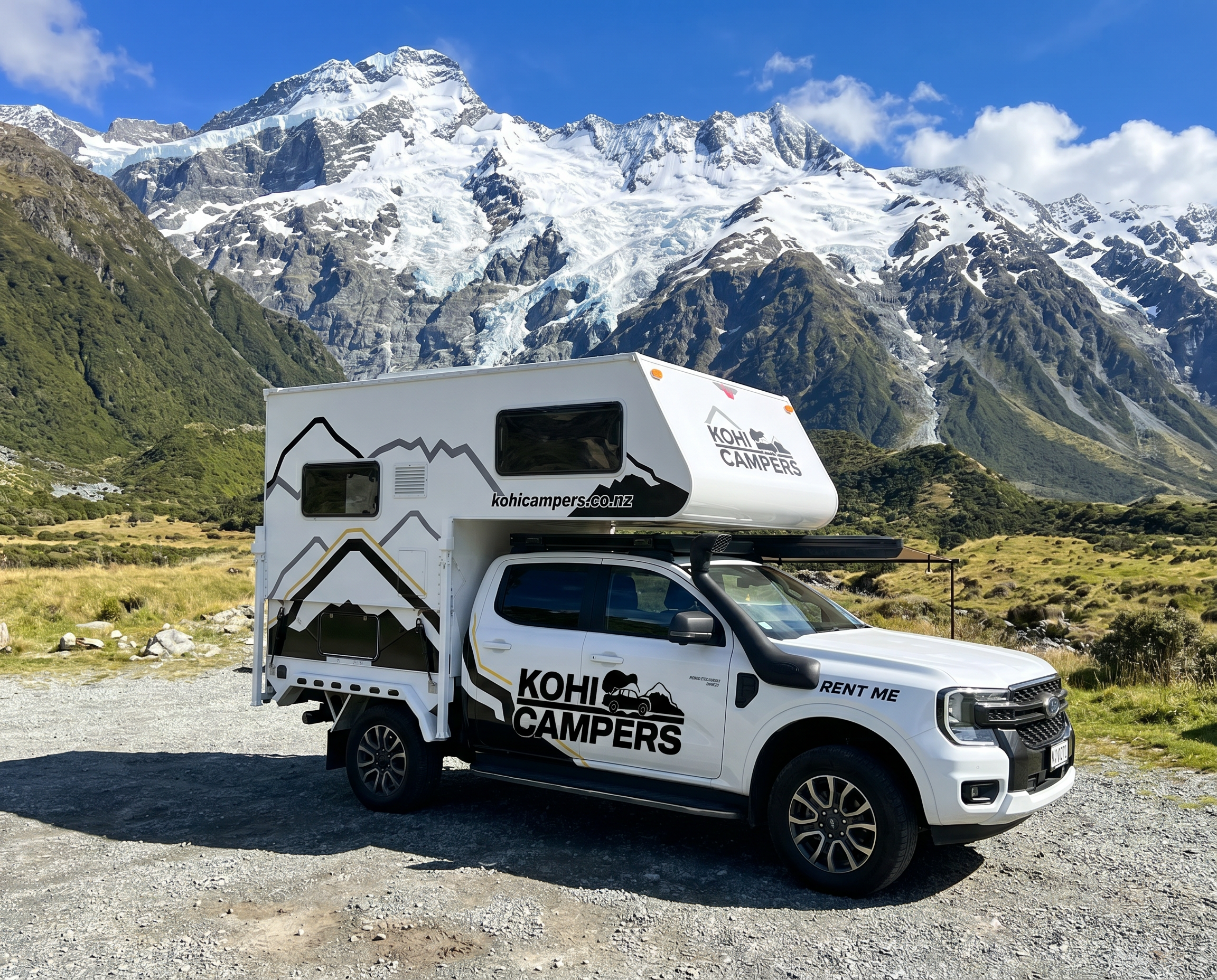
Aoraki Mount Cook National Park sits in the heart of the South Island, three hours inland from Christchurch and a world apart from everything else. At 3,724 metres, Aoraki is New Zealand’s highest peak, flanked by glaciers, turquoise lakes, and some of the most dramatic alpine scenery on earth. It is a place that rewards those who stay longer than a day trip — and with a self-contained setup you can do exactly that.
Getting there
From Christchurch head south on SH1 through Timaru, then turn inland at Washdyke onto SH8 through Fairlie and Tekapo. The drive takes around three hours. From Queenstown it is roughly two and a half hours via Cromwell and Twizel. Both routes are stunning. The last stretch up the Mackenzie Basin on SH80 along the edge of Lake Pukaki, with Aoraki appearing at the end of the road, is one of the great drives in New Zealand.
Fuel up in Twizel before heading into the park. There are no fuel stations at Mount Cook Village.
Where to camp
The Mackenzie Basin and Mount Cook area has excellent freedom camping options for self-contained vehicles. Check CamperMate for current availability and always verify with the Department of Conservation before arrival.
- Lake Pukaki foreshore: turquoise glacial water and direct views toward Aoraki. One of the most photographed freedom camping spots in New Zealand. Get there early to secure a good position.
- Glentanner Park area: just outside the national park boundary, good base for accessing the park and surrounding activities
- Mackenzie Basin sites: numerous freedom camping spots along the basin floor, wide open skies and minimal light pollution
- Lake Tekapo: a short detour on the way in or out, excellent stargazing and the famous Church of the Good Shepherd on the lakefront
Note that camping within the national park itself is restricted to designated DOC sites. Freedom camping is permitted in the Mackenzie Basin outside the park boundary in a self-contained vehicle.
What to do
Hooker Valley Track: the most popular walk in the park and for good reason. A relatively easy three to four hour return walk along the Hooker River with suspension bridges, glacier views, and Aoraki as the backdrop. The terminal lake at the end is filled with floating icebergs. Start early to avoid the crowds that arrive on tour buses mid-morning.
Tasman Glacier: New Zealand’s largest glacier, accessible via the Tasman Valley Road. The Blue Lakes and Tasman Glacier Viewpoint walk takes around an hour return and gives you a view down the length of the glacier. Glacier kayaking and boat tours on the terminal lake are available through local operators.
Kea Point Track: a shorter alternative to the Hooker Valley, this one hour return walk leads to a viewpoint looking across the Mueller Glacier moraine wall. Good chance of seeing kea, New Zealand’s alpine parrot.
Stargazing: the Mackenzie Basin is one of New Zealand’s International Dark Sky Reserves and on a clear night the sky is extraordinary. Lake Tekapo has guided stargazing tours through the University of Canterbury’s Mount John Observatory. Alternatively pull up at any freedom camping spot along the basin floor and watch the Milky Way without any assistance.
Lake Tekapo: worth spending at least a morning here. The Church of the Good Shepherd is the most photographed church in New Zealand. The lakefront has good cafes and in winter the surrounding terrain is skiable at Roundhill ski area.
Twizel: the service town for the Mackenzie Basin. Good supermarket, excellent coffee at a couple of local spots, and access to the canals that are famous for salmon fishing. Pick up a fishing licence at the local outdoor shop.
Best time to visit
Summer (December to March) gives you the longest days and the best conditions for walking. The Hooker Valley Track and surrounding routes are at their best. However the park gets genuinely busy in January and February with international visitors.
Autumn (March to May) is arguably the best time. The crowds thin out dramatically, the light turns golden across the Mackenzie Basin, and the weather is often more settled than summer. The alpine vegetation turns red and orange along the valley floors.
Winter is spectacular if you are prepared for it. Snow on the ranges, frozen lakes, and almost no other visitors. The Kohi Campers setup handles the cold comfortably. Check road conditions before heading in as SH80 can be icy.
Practical notes
- No fuel at Mount Cook Village. Fill up in Twizel without exception
- Mobile coverage is limited in the Mackenzie Basin and non-existent in parts of the national park. Download offline maps and the DOC app before you leave cell range
- Weather in the park changes extremely fast. Check the Mountain Forecast website rather than standard weather apps for accurate alpine conditions
- The Ranger handles the sealed roads throughout the park and basin. SH80 along Lake Pukaki is sealed all the way to Mount Cook Village
- Sandflies are present near water in summer. Insect repellent is essential
- Kea are intelligent and destructive. Do not leave anything accessible on the outside of the camper when parked in the park
Suggested itinerary — 3 nights
| Day | Route |
|---|---|
| Day 1 | Christchurch pickup, drive via SH1 and SH8 to Lake Tekapo. Evening at the lakefront. Camp nearby. |
| Day 2 | Morning at Lake Tekapo, drive SH80 along Lake Pukaki to Mount Cook Village. Hooker Valley Track afternoon. Camp Lake Pukaki foreshore. |
| Day 3 | Tasman Glacier morning. Kea Point Track afternoon. Stargazing at camp. |
| Day 4 | Slow drive back via Twizel, salmon fishing on the canals if time allows. Return to Christchurch. |